
Latest updates
Keep up-
Sign-
If you’d like to receive emails to let you know about important project updates, please click here.
Contacts
Tell us what you think
To contact the Lower Otter Restoration Project, click here.


Q&A
Answers to the most frequently asked questions about the project are available here.
Environment
Environmental Statement
To see the Lower Otter Restoration Project Environmental Statement, click here.
Kier Newsletter
Please click here to read the October 2023 Kier Lower Otter Restoration Project newsletter.
Queen’s Green Canopy
The Environment Agency, on behalf of the Lower Otter Restoration Project, has been granted a virtual plaque after planting 225 trees to form part of the Queen’s Green Canopy which marked the 2022 Platinum Jubilee.
Work to start on removing section of embankment
25 September, 2023: Following the successful installation of the footbridge, work will now commence on removing a section of the existing tidal embankment adjacent to Lime Kiln Car Park.
Click here to read more.


Website designed and maintained by KOR Communications
© Lower Otter Restoration Project


The Lower Otter Restoration Project in the media
Otter Estuary project offers ‘multiple benefits’
Preserving beauty of the South West Coast Path
Estate considers valley flooding retreat plan
2 May 2015: Support from the public will be a major help to a project planning big changes to the Otter Estuary, the proposers have said.
Exmouth Journal
28 July 2014: At this time of year, whilst walking along the South West Coast Path, you can’t help but be struck by the beauty of nature.
Western Morning News
Read more: http://www.westernmorningnews.co.uk/Preserving-
Follow us: @WMNNews on Twitter | westernmorningnews on Facebook
Exmouth Journal
Exmouth Journal
8 September 2010: An east Devon estate may have to make a managed retreat from some land because of future rising water levels, it says.
BBC News

Town’s cricket club would have to find a new home
26 October 2014: Plans to allow the River Otter to reclaim more of its natural flood plain have moved a step forward following public consultations.
Express & Echo
River Otter plan: ‘Low risk’ of pollution
30 November 2015: The risk of ‘toxic’ landfill substances being released by plans to revamp the Otter Estuary is ‘low’, and more surveys will be carried out.
Exmouth Journal
Budleigh Salterton: Meeting to discuss cycle path
6 July 2015: Budleigh Salterton residents facing the prospect of a cycle track being built behind their homes are hopeful their concerns will be listened to.
Exmouth Journal
Otter flooding project: funds to be sought
24 October 2016: A controversial project which could see the Otter Valley flooded may have moved a step closer.
Exmouth Journal
Otter flood project: ‘No significant
cliff impact’
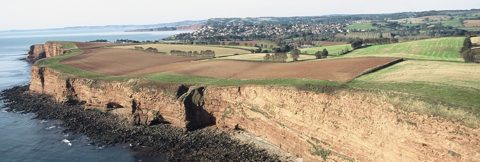
01 November 2016: A report has been published exploring the possible effects of the Lower Otter Restoration Project on cliffs in Budleigh Salterton.
Exmouth Journal
Budleigh residents to have say on Otter project
30 May 2017: Budleigh residents will have a chance to have their say on controversial plans which could see the reintroduction of tidal flooding to the River Otter. Exmouth Journal
'Catastrophic breach' could happen
1 June 2017: A plan to restore the estuary around the River Otter to stop a 'catastrophic breach' of the 200-
Devon Live
Restoring East Devon river to stop 'catastrophic failure'
8 July 2017: Full scale restoration of the River Otter could cost up to £40million it has been revealed. It is one of four options at a public exhibition. DevonLive
River Otter realignment could cost up to £40m
10 July 2017: The cost of a project to secure the future of the Lower Otter Estuary could rise to as much as £40million, according to new plans. Exmouth Journal
Restoration Project now applying for funding
7 August 2018: The £8-
GOV.UK
Agency back £9m scheme to protect defences
6 August 2018: The Environment Agency have said that they are ‘completely committed’ to a £9m scheme to help restore the River Otter.
DevonLive
Agency completely committed to £9million project
7 August 2018: The Environment Agency has announced it is ‘completely committed’ to a £9million project to restore the River Otter.
Exmouth Journal
Funding bid for River Otter project is rejected
24 April 2018: A funding bid for a project that could help avoid a ‘catastrophic breach’ of the sea defences in Budleigh has been rejected.
DevonLive
River project to turn clock back 200 years
14 June 2018: The Lower Otter Restoration Project (LORP) has revealed its latest plans for the estuary as part of proposals to restore it to its historic channels.
Exmouth Journal
Agency committed to £9m River Otter anti-
6 August 2018: The Environment Agency says it is "completely committed" to a £9m scheme to help restore the River Otter in Budleigh Salterton.
BBC News
East Devon Project Now Applying for Funding
8 August 2018: The Environment Agency recently confirmed its commitment to the Lower Otter Restoration Project while applications for funding grants are made.
Dredging Today
Cricket Club get encouraging news about relocation
18 November 2018: Clinton Devon Estates as landowners and partners in the LORP were now progressing a planning application…for a potential new home for the club.
Exmouth Journal

Click here for older news
Budleigh Salterton CC could be set
for new home
22 November 2018: Flood woes could be a thing of the past for Budleigh Salterton Cricket Club after it was revealed it could move to land near East Budleigh.
Exmouth Journal
Plans submitted
for cricket club's new home
26 February 2019: Plans which would see Budleigh Salterton's cricket club relocated have been submitted.
Exmouth Journal
Plans for new home for cricket club revealed
12 March 2019: After nearly 100 years at their Ottermouth home, Budleigh Salterton Cricket Club could be on the move.
Devon Live
Floods force
Devon outfit
into relocating
15 August 2019: Budleigh Salterton Cricket Club are set to relocate as part of a £9m scheme to help restore the River Otter.
The Cricketer
.
Exmouth Journal
Flood-
plans approved
10 January 2020: Budleigh Cricket Club's move away from its flood-
Exmouth Journal
Otter estuary will be flooded after plans approved
£15m plan to restore flood plains approved
6 January 2021: Councillors have unanimously backed plans to restore the Otter Estuary to its natural and historic flood plains.
Devon Live
7 January 2021: A £15m plan to restore the historic flood plains of a Devon estuary have been given the go-
BBC News
Construction update
February 9, 2023: Works to the North of the site have now been completed. This is a huge successful milestone for the project and one which the team are all proud of. For this to happen, the following was undertaken to collectively complete this section: the removal of the existing viaduct allowing the new connection of Budleigh Brook to the new creek channel; some repair works have been implemented to Little Bank following the flood late last year; and the North West footpath including Big Bank footpath have been reopened making a huge impact where the team have received nothing but rave reviews.
To the south of the LORP site (Lime Kiln Car Park area) works have begun to prepare platforms to aid construction of the new South West footbridge. There are currently four separate cofferdams installed where the structures will be built inside, 24 piles have been installed measuring 21 metres deep and the west abutment structural works are now under way.
Work on the South West Footpath continues at pace with alterations to the existing trunk drain alignment. Earthworks have predominantly been completed to allow footpath construction and connectivity from South Farm Road to Lime Kiln Car Park.
Whilst not linked directly to the LORP scheme, but utilising the same work area, the Combined Sewage Overflow (CSO) works being undertaken by Kier Utilities are also progressing well and ahead of programme at the moment, meaning work in and around the area is anticipated to complete ahead of March where the team will be demobilised, reducing the working and compound area, giving it back to public use.

New road opens to the public and drives progress forward at the Lower Otter Restoration Project, giving flood-
March 7, 2023: The newly raised South Farm Road across the Lower Otter Valley at Budleigh Salterton, Devon, is now open to the public following the completion of an embankment and bridge.
Attended by the Environment Agency, Lord and Lady Clinton, and project staff of Clinton Devon Estates, Pebblebed Heaths Conservation Trust, Kier, and several local residents, the first vehicles made their way across the new road and road bridge (a major project milestone) on 4 March. Passing over the new creek network that was created last autumn to carry water in and out of the restored estuary, the raised structure allows for improved public access by providing an all-
The raised road embankment and 30-
Man-
Dan Boswell of the Environment Agency said: "The opening of South Farm Road is a big moment for the project and for the local community. Historically, the area was vulnerable to flooding and tidal events resulting in the former road being closed to the public for significant periods, cutting off important access to homes and businesses. The raised and improved road means these issues will now be a thing of the past, while also allowing the floodplain to return to a more natural state. This represents a real win for both people and wildlife, which is a core aim of LORP, and it's great to see it in action."
Local resident, Judith Beckett said: "As a resident at South Farm, one of the main impacts of the new road will be not having to always keep two weeks' worth of food and fuel supplies in, just in case the road floods and we're unable to get out for several days at a time. Many times over the years, we've had to pull out of social commitments at the last minute, fearing that the road is about to flood -
Nick Pyne, owner of Pynes Farm Shop added "No more tractor rides to get to the other side. We can now open without the concern of being cut off and stranded for days".
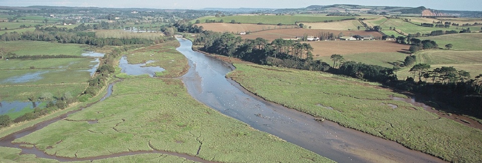
The Lower Otter Restoration Project is an intertidal habitat restoration project delivered by the Environment Agency in partnership with the East Devon Pebblebed Heaths Conservation Trust and Clinton Devon Estates. It is part of a cross-
Other works include restoring 55ha of wetland habitat, the construction of a 70-
.
The newly raised South Farm Road is open
Thousands of new trees to benefit local community, wildlife and environment in the Lower Otter
17 April 2023: The Lower Otter Restoration Project (LORP) in Budleigh Salterton, Devon, is celebrating another key step ahead of its completion later this year, with over 23,000 saplings now planted across the site as part of the works.
Of these trees, 225 were planted as part of the Queen’s Green Canopy scheme, which was launched last year to leave a legacy for the late Queen Elizabeth II.
A significant proportion of this planting is located on the former domestic tip site, which has been raised to enable it to be reclaimed by nature and become a pleasant green space for the community and visitors. Earlier this month, Simon Jupp, MP for East Devon, joined Andrea Ayres, Operations Manager at the Environment Agency, to plant a tree on the tip site, view the project’s progress, and celebrate World Planting Day.
Species planted include a mix of canopy species trees and understory shrubs and small trees such as field maple; silver and downy birch; crack, grey, goat and white willow; guelder and dog rose; crab apple; wild cherry; hawthorn; blackthorn; hornbeam, and pedunculate and sessile oak.
New hedgerows have also been planted, and other existing hedgerows have been thickened and improved. This helps improve connectivity through the landscape for wildlife such as dormice and birds that rely on them for refuge, and bats that use them to navigate.
Trees and hedgerows provide many benefits: they create vital habitat for small mammals, birds and insects; increase local biodiversity; ‘lock-
LORP’s extensive planting scheme continues to create more woodland and offsets the removal of some mature trees earlier in the project. Vegetation was initially cleared to provide the open estuarine habitat necessary to attract waders and other key bird species (wading birds need far-
Dan Boswell of the Environment Agency said: “This is another big step forward for the project and our efforts to restore the Lower Otter Valley to a more natural state. The planting addresses some of the ecological and environmental challenges we have in the area and will play an important role in enhancing local biodiversity and visitor’s experiences.
“It is early days, but the Lower Otter Restoration Project is already having clear positive effects on the valley’s ability to attract more and more varied birdlife, and as these saplings grow and the newly restored wetlands develop, this will greatly increase.”
The Lower Otter Restoration Project is an intertidal habitat restoration project delivered by the Environment Agency in partnership with the East Devon Pebblebed Heaths Conservation Trust and Clinton Devon Estates. It is part of a cross-
Works include a 70-
For more information on the PACCo initiative, visit: www.pacco-
New trees are being planted in the Lower Otter

Ground-
• New PACCo guide provides framework for the future of coastal communities
• Transferrable model aimed at policymakers, contractors and community leaders
• Practical tools and lessons learnt to support further climate adaptation
May 11, 2023: As the impacts of climate change continue to be felt around the world, coastal communities are especially vulnerable to the increasing risks caused by rising sea levels and extreme weather events.
To help communities adapt to these challenges by joining forces with nature, the Promoting Adaptation to Changing Coasts (PACCo) project -
A €27million EU Interreg project led by the Environment Agency, PACCo is the first of its kind to demonstrate large-
The new resource provides step-
An internationally replicable strategy that is already demonstrating its aims to build flood and erosion resilience, reverse habitat and biodiversity loss, and increase carbon capture and socioeconomic value, it is estimated that around 70 estuarine sites in northern France and southern England alone may benefit from a similar model.
Dr Lydia Burgess-
“The guide has been developed from years of cross-
A marker of its early success, PACCo has recently been shortlisted as a finalist for the Flood & Coast Excellence Awards 2023. The accolade recognises initiatives across the flood and coastal risk management (FCRM) sector that have made outstanding contributions towards protecting coastal communities and environments.
The winners will be announced at the Flood & Coast Conference 2023 (6-
The PACCo Guide and summary are available for free download via the PACCo website (www.pacco-
The guide -
The summary – PACCo Guide Executive Summary
A wide range of additional and supporting resources can also be found on the website including science reports, newsletters, blogs, and videos.

Stakeholder update: 6 June 2023
The Kier and Environment Agency site presence
Over the next few weeks, you may notice some changes as we near the end of the construction phase of the project. The offices at South Farm Rd will be removed from the 8th June. Work will now be focussed at the very south of the site -
South Farm Road
Flash flooding hit areas of East Devon with very heavy rainfall experienced this May. The site area also flooded but we were pleased to observe that the newly raised South Farm Road was unaffected by flood water and provided access for businesses and residents regardless of the rising levels on the River Otter.
Footpaths open
We are pleased to say that the improved footpath on the west of the side of the valley between South Farm Road and Lime Kiln car park (BS 12) has been completed and it has been open to public use. Works around the underside of the new bridge will mean that there will be temporary closures of this footpath. However, please be assured that this footpath (both north and south of the new road bridge) will be fully operational in time for the summer holidays. We are also to open the newly created footpath on the former tip in July. In total, we will have improved access to 3.3km of foot path, raised circa 2.5km of footpath, constructed over 600m of pavement and created over 500m of new public right of way footpath.
Temporary diversions will also be required for the periods of footbridge installation and connection of the creeks to the estuary (this will include the South West Coast Path) -
 New footpath on former tip area -
Connecting to the Estuary
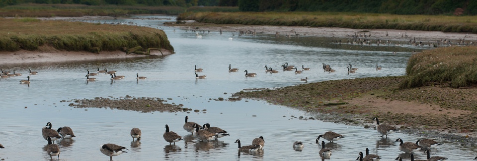
We were due to reconnect the Lower Estuary by removing a section of the existing tidal embankment this spring. However, significant numbers of ground nesting birds have already been attracted to the habitat created on site, including schedule 1 species (birds designated for their rarity, vulnerability, and sensitivity to disturbance). We have therefore rescheduled this work for the end of summer.
Project Manager Dan Boswell stated: "The sheer quantity of birdlife using the site is a mark of the success that we have had both in working sensitively alongside wildlife, minimising detrimental disturbance and in unlocking the potential of the site for wildlife through the habitat we are creating. It is likely that the Schedule 1 species that we believe bred for the first time on the Lower Otter last year, has returned to enjoy the favourable conditions the project is creating to nest and rear young."
It's important to note that the breach won't be a single dramatic moment on one day. It's a process that will take approximately 6 weeks. This is a really important milestone for LORP but it will be slow and controlled, with work carried out in stages at low tide. As the new habitats develop, with more exposed mud, new invertebrates such as worms and snails will colonise them. These will provide food for wading birds such as black-
Environment and Biodiversity
The project is starting to show the positive impacts we planned, demonstrating that if you improve conditions, wildlife will adapt accordingly. We are now seeing species that haven't previously been recorded at the site. Currently it's a freshwater wetland so species will change again once the site becomes fully intertidal.
We have planted over 23,000 trees. A significant proportion of the planting is located on the former domestic tip site, which has been raised to enable it to be reclaimed by nature and accessed (via the new footpath) by the community. 225 of the trees planted on site were planted as part of the Queen's Green Canopy scheme, which was launched last year to leave a legacy for the late Queen Elizabeth II.
New hedgerows have also been planted, and other existing hedgerows have been thickened and improved. This helps improve connectivity through the landscape for wildlife such as dormice and birds that rely on them for refuge, and bats that use them to navigate.
Power lines removed from valley
1.5km of visually intrusive overhead powerlines have been buried on the western side of the valley as part of the LORP project. In addition, a further 1km was removed on the eastern side of the river from South Farm to the coast. In undertaking this work we partnered with a programme funded by Western Power Distribution (now National Grid) and the East Devon AONB.
Clinton Devon Estates and the East Devon Pebblebed Heaths Conservation Trust: Managing the Reserve Post construction
Clinton Devon Estates and their conservation charity the East Devon Pebblebed Heaths Conservation Trust (EDPHCT) have been working on viewing areas for people to use to sit and enjoy the nature reserve. Four viewing areas are already open alongside public footpaths on the main embankment and on Big Bank, with a fifth soon to open on the old tip. The viewing areas in the new nature reserve car park on South Farm Road and in Lime Kiln car park will be installed once the main Kier work is complete in these locations. New orientation signs are also being installed at all the entry points to the nature reserve. These have a useful map of the reserve and information on how visitors can help care for the site during their visit. The Estate's Conservation Trust also manages the core areas of the Pebblebed Heaths.
A new Ranger -

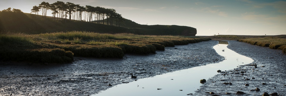
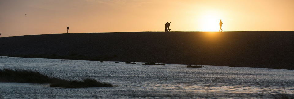
Looking north from the beach at Budleigh Salterton
August 2023 update on Lower Otter works
The final work to reconnect the Otter estuary to its floodplain will begin Monday 14th August. This significant stage in the project will see the new footbridge installed, a 70-
The work can only be done at low tide which may mean working outside of normal hours. The location of this work will cause some temporary disruption to parking in the northeast corner of Lime Kiln car park. Areas of the car park will be re-
As you may be aware it was not possible to complete the works prior to the summer holidays due to the presence of nesting birds. It is also not possible to delay these works until later in the year, as installing the bridge requires low wind speeds. This combination of circumstances means there is no alternative but to work during the busier summer period; the team would like to thank you for your understanding and continued patience.
From the Monday 4th September (to the end October), the South West coast path from the car park to White Bridge will be temporarily diverted. The diversion will be via the newly surfaced footpath (BS12) on the western edge of the valley, from Granary Lane to South Farm Road. If it is deemed safe by the project team, temporary access to the closed section of coast path may* be allowed for a short period during this time.
We hope that walkers will continue to enjoy the newly surfaced path on the west of the side of the valley (BS12). The footpath on the west of the valley north from South Farm Road, to Big Bank (EB3) will re-
* This temporary opening cannot be guaranteed.
** In total, we will have improved access to 3.3km of foot path, raised circa 2.5km of footpath, constructed over 600m of pavement and created over 500m of new public right of way footpath.


Lower Otter Restoration Project nears completion
11 September, 2023: One of the biggest coastal climate adaptation and habitat creation projects in England moves a step closer to final completion with the installation of a new 70-
The Lower Otter Restoration Project (LORP) is a partnership initiative between landowners Clinton Devon Estates and the Environment Agency to restore the historic floodplain of the Otter estuary near Budleigh Salterton, East Devon.
The Environment Agency managed the development of the scheme, appointing engineering consultant Jacobs to lead the design of the project and contractor Kier to undertake the construction works. Once construction is complete, the 55-
Over the last week, a new 70-
Installation of the new footbridge secures continued access along the South West Coast Path following the connection of the historic floodplain to the Otter estuary (please note the South West Coast path will remain temporarily diverted until the end of October to enable completion of works). This work was initially planned for earlier in the year but was postponed to allow breeding birds (who were flocking to make use of the new habitat) to finish nesting in the area that will flood tidally.
The project has already made a positive difference to the local community. During heavy rain in May, South Farm Road, once notorious for flooding, but which has been raised by the scheme, stayed free of the rising water, allowing local businesses to continue trading and residents to move freely. Budleigh Salterton Cricket Club, whose ground in the past was frequently subject to serious flooding, have been playing this season on a new flood-

Dr Sam Bridgewater, Director of Environment Strategy and Evidence at Clinton Devon Estates said: "After more than a decade of planning and hard work, it is fantastic to see the project nearing completion. The benefits for people and the planet are already clear to see. It's really encouraging that a wide variety of bird species have been visiting the site during the construction phase and we look forward to seeing further wildlife gains as the landscape and habitats develop once the lower valley again becomes tidal as it was two hundred years ago."
Environment Agency Project Manager Dan Boswell reflected "Undertaking landscape change of this scale is a huge challenge in terms of engineering, the environment and communication. The efforts of the team to rise to these challenges and deliver a fantastic legacy for the local community as well as improving the environment are to be commended. We are already seeing the positive impact for people and wildlife and that will only increase with time."
Ecologists working on LORP are confident that habitats developing in the newly restored intertidal zone will increase biodiversity. Mud colonised by invertebrates will provide rich feeding grounds for wading birds like black-
Members of the public can already enjoy the improvements and the wildlife they have attracted through 3.3km of improved footpath network that is more resilient to flooding as sea levels rise. 7 new viewing areas have also been constructed to enable visitors to enjoy and learn about the new wildlife have also been built with orientation signs, including a map and information on how to help care for the site.
In addition, unsightly overhead power lines that once ran through the site have been buried on both sides of the Otter valley, putting 2.5km of cables below ground. The work was undertaken in partnership with National Grid and the East Devon Area of Outstanding Natural Beauty.

A bridge section is lowered into place. Pictures courtesy of Clinton Devon Estates
Work to start on removing section of embankment
25 September 2023: Following the successful installation of the footbridge, work will now commence on removing a section of the existing tidal embankment adjacent to Lime Kiln Car Park.
This work will be undertaken in a controlled manner (over a period of weeks) and from this point in time, the tide will enter and drain the floodplain through the gap in the embankment.
The depth of water in the new habitat area will depend on the state of the tide (high or low and whether we are at springs or neaps) and the progress of the embankment removal.
Footpath users please note: as previously notified, from this point onwards some footpaths may be inundated at high tide (though there will be a reduction in the duration for which paths are affected by river flooding). Signage of affected paths are already present around the site. The various footpaths around the site are at different heights relative to sea level and will not all be inundated with the same frequency. Tide timetables are available in the form of QR codes on the signs to enable walkers to plan their routes. The frequency of inundation of both the South West coast path and the riverside path to Otterton will be unchanged. The new footpath on the former tip and the footpath on South Farm Road (which used to flood most years for an extended duration) will now only flood during exceptional flood events, following raising works undertaken by the scheme.
What to expect from the transition to intertidal habitat. As the site is successively inundated by waters from the Otter estuary on each high tide, silts will be deposited, and the site will begin its slow transition from low-
This transition will take time. Initially, low-
This is a very exciting milestone and will increasingly benefit people and wildlife in the Lower Otter Valley.
The 70-
Nature Reserve car park open on South Farm Road
25 September 2023: The new Otter Estuary Nature Reserve car park on South Farm Road is now open.
This is another significant step towards the completion of the Lower Otter Restoration Project. The new parking area has fantastic views over the heart of the reserve and is well connected to the recently improved footpath network, making it a brilliant place to start your walk. A viewpoint seating area has been carefully placed to make the most of the view from the car park, the seating is still being crafted and is due to be finished soon.
Parking fees apply in this car park. The car park will be managed by the Pebblebed Heaths Conservation Trust, all funds generated will be reinvested back into the management of the nature reserve, upkeep of visitor facilities, and to support our public engagement and educational work. The parking payment machine will accept cash and card or you can use the Ringo parking app. There are three blue badge bays which are free to use for those who are eligible.
The new Nature Reserve car park
